
North Guardian Angel is a summit in Zion National Park, Washington County, Utah, on National Park Service land. You are in the Escarpments, a region of the Colorado Plateaus. Highlights include waterfalls.
Parking is about 1.9 miles away. The nearest trail is about 0.5 miles away. Springdale is about 9.4 miles away, and Cedar City is the nearest city at about 25 miles.
In the area you might come across Archangel Falls, R3 - Keyhole Falls - Bolted Rappel Anchor: 10 ft. and R2 - Bolted Rappel Anchor: 6 ft. (waterfall). Close by are Northgate Peaks, West Northgate Peak and Overlook. Nearby trails include The Subway Top-Down Approach and The Subway Bottom-Up Approach.
It is one of 83 summits in Zion National Park. Things to do here might include hiking and trail running. See North Guardian Angel with someone who knows the trails.
Everything in Zion National Park →Guide & Outfitter Permits
Not currently issuing new commercial permits
Fees: Application fee $350 first / $250 subsequent same season; tiered management fee 3-5% of gross receipts.
Minimum insurance required: Not stated on page.
Organized group / event permits: offered
Caps / application windows: "The application window for the 2026 Commercial Use Authorization (CUA) program closed at 11:59 p.m. on March 31, 2026." Only Transport (non-tour) Commercial Shuttle Service applications remain open. "Road-based tours are NOT being issued for 2026." Separate Special Use Permits page covers weddings, assemblies, athletic events.
Check for restricted areas. Whatever the permit status above says, parts of an area can be closed or restricted (a zone, trail, season or wilderness area). Check with the managing agency before you visit or guide here.
Attested from the agency's own published page, not verified by MagellanX in person.
Nearby
Northgate Peaks summit West Northgate Peak summit The Subway hiking trail Overlook overlook South Guardian Angel summit The Subway Top-Down Approach hiking trail Pine Valley Peak summit Greatheart Mesa summitSummary
Visitors can bike, camp, climb, hike and watch wildlife, according to the National Park Service. There are 5 reservable campgrounds within about 25 miles, the nearest being Lava Point Campground (4.8 miles). The nearest emergency room is Cedar City Hospital in Cedar City, 26 miles away; the nearest commercial airport is Cedar City Regional Airport, 27 miles away. Typical highs run from 52 to 100°F; March to May is the most comfortable stretch and June to August the hottest.
Things to Do
As listed by the managing agency on Recreation.gov. Park information: (435) 772-3256.
Getting There
Straight-line distances from this pin. Source: OurAirports.
Where to Stay
Sources: Recreation.gov and OpenStreetMap. Check the booking page for fees and availability.
Safety
In an emergency call 911. Cell service can be limited here. Source: OpenStreetMap.
Weather
Typical Weather by Month
Average high (°F) by month, 1991-2020. Blue: cold, green: comfortable (60-85), orange: hot.
Best time to visit: March to May for the most comfortable weather. Hottest: June to August. Driest: June and May. Typical weather only; it does not account for crowds, closures or events.
Sources: National Weather Service (live) and NOAA climate normals from the Zion Np station (4,038 ft, 8.5 miles away).
Photos of Zion National Park
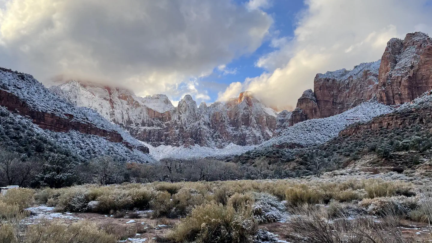


Photos via Recreation.gov, credited as the agency provides them.
Go with a local
Go with someone who knows Zion National Park.
Request an independent guide in the MagellanX app, book a trip a guide has already planned, or find a local outfitter or peers to hike with. Then meet up and go.
Outfitters That Guide near Here
26 outfitters are listed near here (see Outfitters Near on this page).
Get the MagellanX App

Guide or outfitter? Same app. Post your trips and take requests.
Keep Me Posted
We are building MagellanX as we go. Want occasional updates as new places, features and guides arrive?
Occasional emails only. Unsubscribe any time.
National Parks
- Great Smoky Mountains National Park
- Yellowstone National Park
- Glacier National Park
- Appalachian National Scenic Trail
- Kings Canyon National Park
- Santa Monica Mountains National Recreation Area
- Olympic National Park
- Sequoia National Park
- Rocky Mountain National Park
- Blue Ridge Parkway
- Yosemite National Park
- Grand Canyon National Park
- Death Valley National Park
- Golden Gate National Recreation Area
- Mississippi National River and Recreation Area
- Cuyahoga Valley National Park
- Shenandoah National Park
- Mount Rainier National Park
- North Cascades National Park
- Grand Teton National Park
- Redwood National Park
- Acadia National Park
- Lake Mead National Recreation Area
- Delaware Water Gap National Recreation Area
- Mojave National Preserve
1 / 15 Next →
National Forests
- National Forests in North Carolina
- Shasta-Trinity National Forest
- White River National Forest
- Sierra National Forest
- Plumas National Forest
- Grand Mesa, Uncompahgre and Gunnison National Forests
- Superior National Forest
- Tongass National Forest
- Cherokee National Forest
- Six Rivers National Forest
- Rio Grande National Forest
- Okanogan-Wenatchee National Forest
- Pike and San Isabel National Forests
- Uinta-Wasatch-Cache National Forest
- Chattahoochee-Oconee National Forests
- Klamath National Forest
- George Washington and Jefferson National Forest
- Tahoe National Forest
- Ottawa National Forest
- Coconino National Forest
- Nez Perce-Clearwater National Forest
- Arapaho and Roosevelt National Forests
- Mt. Baker-Snoqualmie National Forest
- Humboldt-Toiyabe National Forest
- Willamette National Forest
1 / 5 Next →
State Parks
- Chugach State Park
- Patapsco Valley State Park
- Anza-Borrego Desert State Park
- Baxter State Park
- Harriman State Park
- Henry W. Coe State Park
- Mount Diablo State Park
- Gunpowder Falls State Park
- Humboldt Redwoods State Park
- Wasatch Mountain State Park
- Porcupine Mountains Wilderness State Park
- Delaware and Raritan Canal State Park
- Cherry Creek State Park
- Big Basin Redwoods State Park
- Ringwood State Park
- Allamuchy Mountain State Park
- Henry Cowell Redwoods State Park
- Delaware Canal State Park
- Custer State Park
- Hennepin Canal Parkway State Park
- Rockefeller State Park Preserve
- Letchworth State Park
- Cloudland Canyon State Park
- Cuyamaca Rancho State Park
- Brown County State Park
1 / 91 Next →
Tribal Land & Reservations
- Seminole OTSA
- Yakama Nation Reservation
- Oneida Indian Nation Reservation
- Wind River Reservation
- Ninilchik ANVSA
- Osage Reservation
- Navajo Nation Off-Reservation Trust Land
- Four Winds Cherokee SDTSA
- Iowa OTSA
- Kickapoo OTSA
- Jicarilla Apache Nation Reservation
- Cher-O-Creek SDTSA
- Coharie SDTSA
- Colville Reservation
- Caddo-Wichita-Delaware OTSA
- Hoopa Valley Reservation
- Natchitoches SDTSA
- Tohono O'odham Nation Reservation
- Fort Berthold Reservation
- Southern Ute Reservation
- Northern Cheyenne Indian Reservation
- Quinault Reservation
- United Houma Nation SDTSA
- Red Lake Reservation
- Occaneechi-Saponi SDTSA
Browse Parks by State
- Alabama
- Alaska
- Arizona
- Arkansas
- California
- Colorado
- Connecticut
- Delaware
- Florida
- Georgia
- Hawaii
- Idaho
- Illinois
- Indiana
- Iowa
- Kansas
- Kentucky
- Louisiana
- Maine
- Maryland
- Massachusetts
- Michigan
- Minnesota
- Mississippi
- Missouri
- Montana
- Nebraska
- Nevada
- New Hampshire
- New Jersey
- New Mexico
- New York
- North Carolina
- North Dakota
- Ohio
- Oklahoma
- Oregon
- Pennsylvania
- Rhode Island
- South Carolina
- South Dakota
- Tennessee
- Texas
- Utah
- Vermont
- Virginia
- Washington
- West Virginia
- Wisconsin
- Wyoming